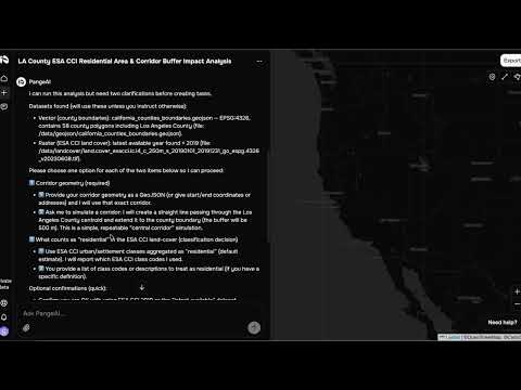
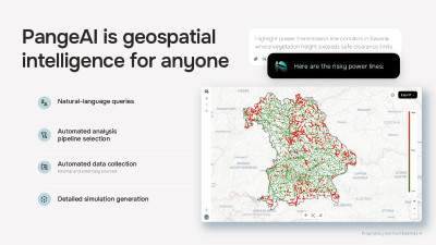
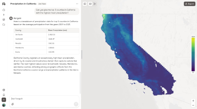
PangeAI introduces a groundbreaking agentic layer that intelligently processes and analyzes complex geospatial data, including high-resolution satellite imagery, intricate vector geometries, and diverse coordinate systems. This innovative platform empowers organizations to answer critical physical-world questions with unprecedented speed and accuracy, entirely eliminating the need for a dedicated GIS team. Imagine getting answers to queries like 'Which of my 400 sites experienced flooding last month?' in minutes, not weeks. Developed through a synergistic collaboration between Silicon Valley and Europe, PangeAI transforms how you interact with and derive insights from geographical information.


Categories:
Launch Team / Built with
Launch Date:
April 23, 2026
Product Info
Awards
#5 of the Day